
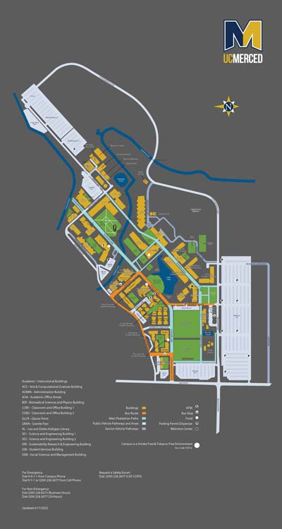
Maps

Download a PDF map of campus. Updated April 2023
UC Merced, 5200 N. Lake Road, is about eight miles northeast of the city of Merced’s downtown area. Driving directions to the campus from the region’s major airports (San Francisco, Sacramento, San Jose and Fresno) are available online.
Driving directions for travelers coming to campus by way of Highway 99 — the nearby state route that stretches nearly the entire length of California’s Central Valley — are:
Directions from southbound Highway 99
- Head southeast on CA-99 South.
- Take Exit 187B toward Martin Luther King Jr. Way.
- Turn left onto CA-59 North/Martin Luther King Jr. Way.
- Take the third right onto West 16th Street.
- Take the third left onto G Street.
- Turn right onto East Bellevue Road.
- Turn left at Lake Road.
- Arrive at main entrance to the UC Merced campus.
Directions from northbound Highway 99
- Head northwest on CA-99 North.
- Take exit 187A for G Street.
- Turn right onto G Street.
- Turn right onto East Bellevue Road.
- Turn left at Lake Road.
- Arrive at main entrance to the UC Merced campus.
A campus map, including buildings, landmarks, roads and other points of interest, is available online and can be downloaded and printed.